K20th Century
Featured
British India George V One Rupee 1918
₹8,200.00₹9,500.00
Move over the image to zoom · tap on mobile to enlarge
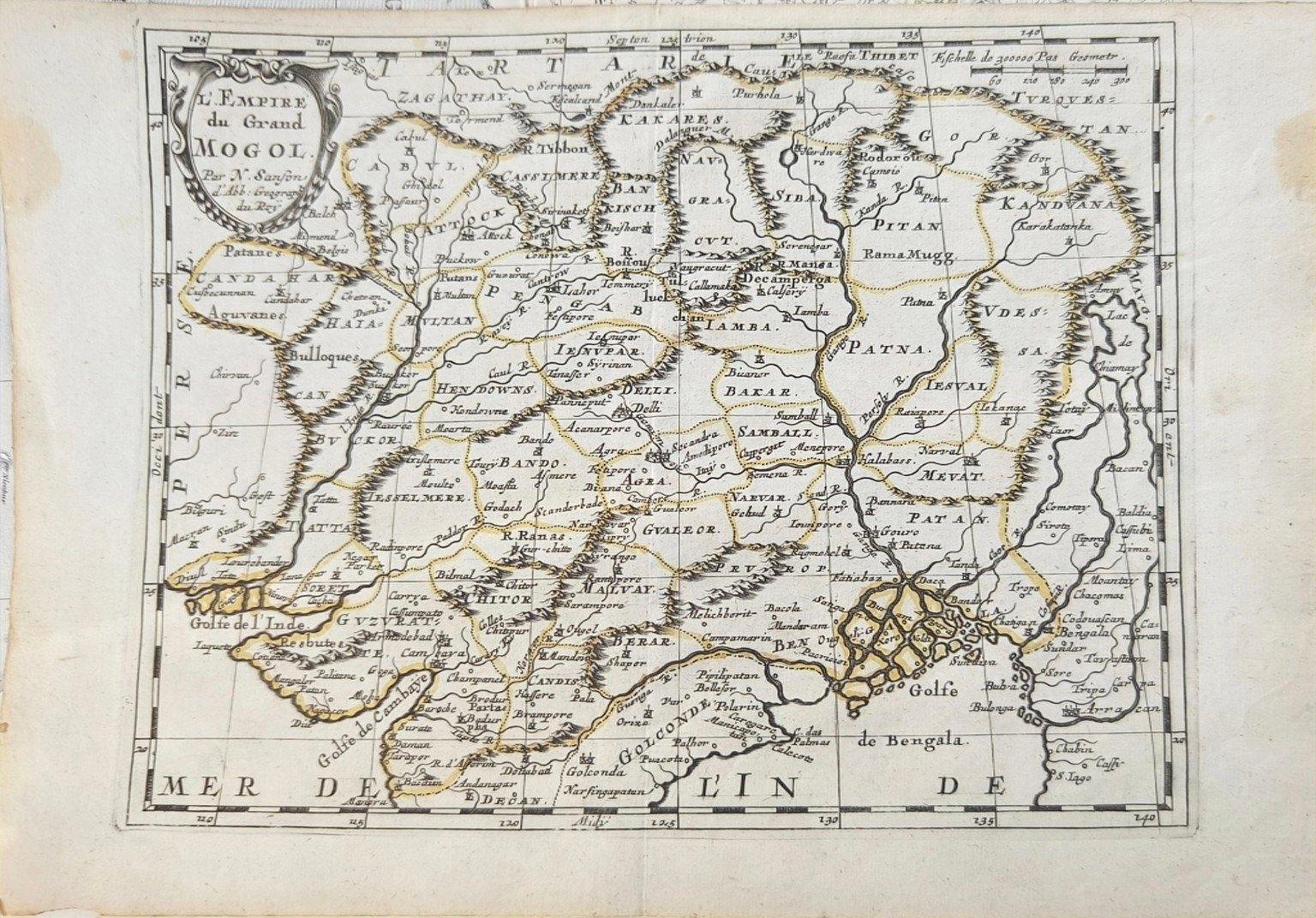
An exceptional 17th-century copperplate map of the Mughal Empire, by the celebrated French cartographer Nicolas Sanson (1600–1667).
Titled L'Empire du Grand Mogol, the map depicts the Mughal dominions and surrounding regions as understood by European cartographers during the mid-17th century. It includes a remarkable network of historical cities, rivers, mountain ranges, provinces and territories covering much of the Indian subcontinent.
The map was engraved by Abraham Peyrounin in Paris and belongs to Sanson's important cartographic work on Asia. The map was first published in 1652, while the present sheet, which does not bear a visible printed date, is conservatively attributed to approximately 1654–1665.
Particularly fascinating to collectors of Indian history, the map provides a European geographical representation of Mughal India during the reign of Emperor Shah Jahan, only a few years before the accession of Aurangzeb.
The map retains its characteristic antique appearance, including the central vertical fold, age toning, foxing and signs of historical handling.
A fascinating original 17th-century cartographic record of how Mughal India was perceived in Europe more than three centuries ago.